Pinnacles National Park Overview
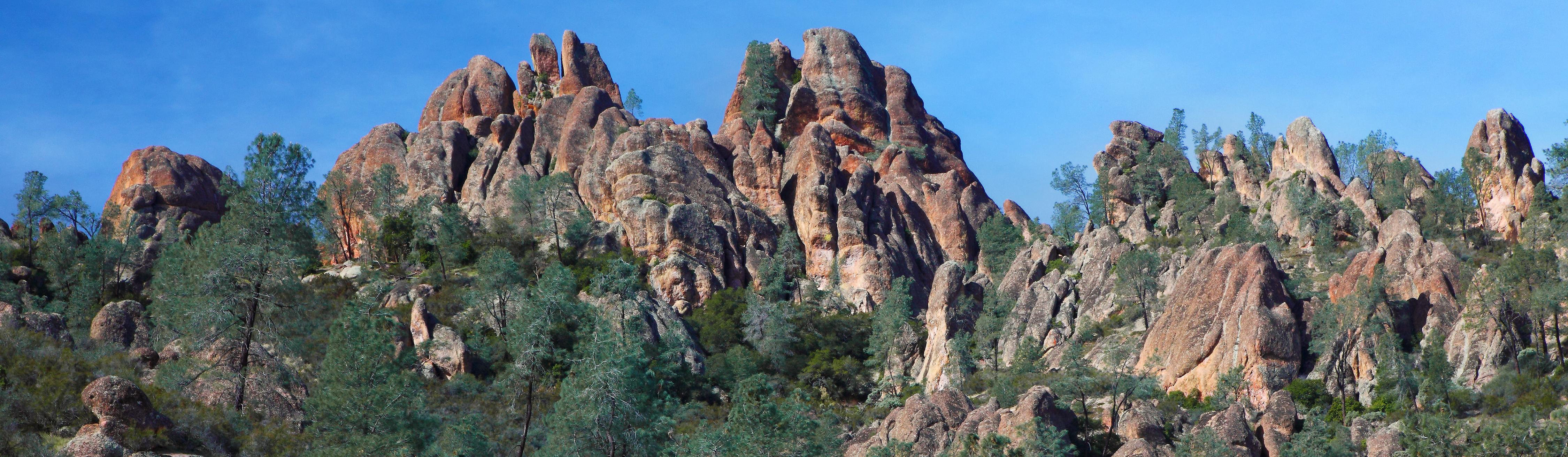
Pinnacles National Park protects about 26,685 acres of volcanic spires, talus caves, chaparral, oak woodlands, canyons, and California condor habitat in central California. The park recorded 348,030 recreation visits in 2025, making it a smaller and more rugged alternative to California's better-known mountain and coastal parks. Visitors come for steep trail routes, spring wildflowers, cave passages, rock formations, birding, climbing, and the chance to see condors soaring over the High Peaks.
The landscape began far to the south as part of an ancient volcanic field, then moved north along the San Andreas Fault over millions of years. Erosion left the dramatic pinnacles, cliffs, boulders, and cave-like talus passages that define the park today. The east and west entrances do not connect by road inside the park, so planning which side to enter matters before choosing a hike, campground, or scenic stop.
Pinnacles was first protected as Pinnacles National Monument in 1908, when President Theodore Roosevelt used the Antiquities Act to preserve its unusual volcanic formations. It became Pinnacles National Park on January 10, 2013, after years of local and conservation support for stronger recognition of its geologic story, wildlife habitat, and public recreation value.
For more information see the park's Wikipedia page.
For official park information, visit the official NPS page.
Top Hikes
Use the NPS Trails page for current cave closures, heat, and trail conditions before hiking. Bring a flashlight for routes that pass through talus caves.
Moses Spring to Rim Trail Loop is a 2.2-mile (3.5 km) round trip with about 500 feet (152 m) of elevation gain through Bear Gulch Cave, reservoir scenery, and rock formations.
Condor Gulch to High Peaks Loop is a 5.3-mile (8.5 km) round trip with about 1,300 feet (396 m) of elevation gain to High Peaks views and possible condor sightings.
High Peaks to Bear Gulch Loop is a 6.7-mile (10.8 km) round trip with about 1,425 feet (434 m) of elevation gain through wildflower slopes, High Peaks, and shaded descent routes.
Old Pinnacles Trail to Balconies Cave is a 5.3-mile (8.5 km) round trip with little net elevation gain along Chalone Creek to Balconies Cave and Machete Ridge views.
Chalone Peak Trail is the long Pinnacles hike, about 9 miles (14.5 km) round trip with about 2,040 feet (622 m) of elevation gain to the highest point in the park.
Pinnacles National Park Backpacking
Backpacking is not a standard activity at Pinnacles because the park does not offer a broad overnight backcountry trail system. Most visitors build a day around linked hikes, cave routes, overlooks, wildlife viewing, and the campground near the east entrance. The NPS Cave Status page is important because Bear Gulch Cave and Balconies Cave can close for flooding, rockfall, bat protection, or seasonal conditions.
Things to Do in Pinnacles National Park
Use the NPS Things To Do page for current activity ideas, seasonal guidance, accessibility notes, and park alerts before planning your visit.
California condor viewing is a major reason to visit. High Peaks and open ridgelines can be good places to scan for condors, turkey vultures, and raptors while keeping distance from wildlife.
Rock climbing is another important Pinnacles activity, with routes on volcanic breccia formations. Climbers should check seasonal closures, raptor protections, and current park guidance before choosing routes.
The east entrance is best for the visitor center, campground, and Bear Gulch area; the west entrance is useful for Balconies and west-side scenery. Summer heat can be intense, while winter and spring often bring cooler weather, greener hillsides, and better wildlife viewing.
Pinnacles National Park Camping and Lodging
Pinnacles Campground is located on the east side of the park and is the main developed overnight option. It offers tent, group, and RV sites, with water and campground services available through the park concessioner.
There is no road through the park to the west entrance, so campers should plan around east-side access. Lodging, restaurants, fuel, and supplies are available in nearby gateway communities such as Soledad, Hollister, King City, and Paicines.
Pinnacles Campground reservations are handled through Recreation.gov.
Official Pinnacles National Park Resources
Use the official NPS page, park map, and current alerts, plus reservation links when planning a trip to Pinnacles National Park.