Voyageurs National Park Overview
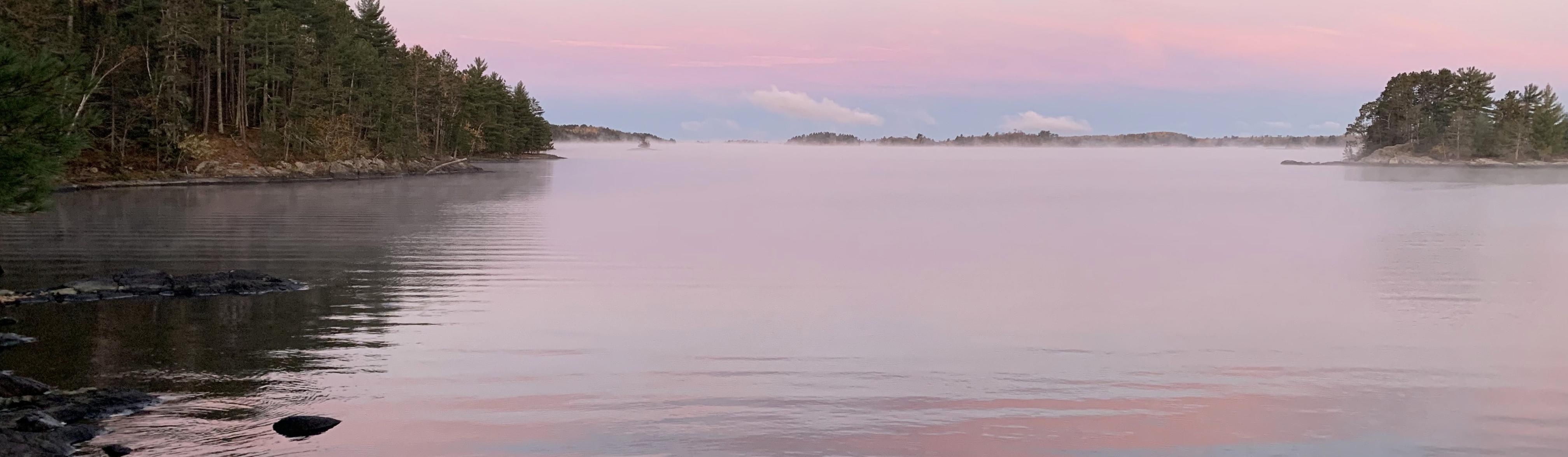
Voyageurs National Park protects about 218,222 acres of northern Minnesota boreal forest, lakes, islands, wetlands, and waterways along the Canadian border. The park recorded 206,326 recreation visits in 2025, with many trips centered on Rainy, Kabetogama, Namakan, Sand Point, and Crane lakes. Voyageurs is a water-based park, so boats, paddling routes, water taxis, winter ice travel, and campsite permits shape most visits more than roads do.
The park preserves a glaciated lake country landscape with rocky shorelines, quiet bays, inland lakes, dark skies, and habitat for loons, beavers, bald eagles, wolves, black bears, and moose. It also protects the history of Ojibwe homelands, French-Canadian voyageurs, fur trade routes, logging, commercial fishing, and gold exploration. Visitors should plan with weather, water temperature, boat access, and navigation in mind.
Voyageurs was established on April 8, 1975, after decades of proposals to protect the border-lake country. Its name honors the voyageurs who paddled trade routes through the region, but the park's deeper history begins with Indigenous use and stewardship of the waterways long before the fur trade.
For more information see the park's Wikipedia page.
For official park information, visit the official NPS page.
Top Hikes
Use the NPS Hiking Trails page for current Voyageurs trail conditions. Some hikes are land-accessible, while others require a boat or water taxi.
Oberholtzer Trail is about 1.7 miles (2.7 km) round trip with minimal elevation gain through forest and wetland scenery near the Rainy Lake Visitor Center.
Echo Bay Trail is about 2.5 miles (4 km) with minimal elevation gain through forest, wetlands, and birding habitat.
Blind Ash Bay Trail is about 2.5 miles (4 km) with roughly 150 feet (46 m) of elevation gain to forest and lake views near Ash River.
Anderson Bay Trail is about 1.7 miles (2.7 km) with roughly 150 feet (46 m) of elevation gain to rocky overlooks; access requires boat travel.
Kab-Ash Trail is the long land route, with connected sections totaling about 27.5 miles (44.3 km) and rolling elevation change through forest between Kabetogama and Ash River.
Voyageurs National Park Backpacking
Backpacking is possible, but it works differently than in many parks. The NPS Camping page explains that backcountry campsites may require a boat ride to a trailhead followed by hiking, while primitive Kab-Ash Trail sites can be reached from mainland trailheads. Permits and Reservations are important because all overnight camping in the park requires planning.
Things to Do in Voyageurs National Park
Use the NPS Things To Do page for current activity ideas, seasonal guidance, accessibility notes, and park alerts before planning your visit.
Boating is the signature thing to do in Voyageurs National Park because most campsites, shorelines, and lake destinations are reached by water. Rainy Lake, Kabetogama Lake, Namakan Lake, Sand Point Lake, Ash River, and Kettle Falls all shape different trip styles.
Fishing is one of the park's strongest activities, with walleye, northern pike, smallmouth bass, and other species drawing many visitors. Regulations, seasons, and weather should be checked before planning time on the water.
Paddling, houseboating, Ellsworth Rock Gardens, wildlife viewing, and northern lights photography add variety in warmer months. Winter brings ice roads, snowshoeing, skiing, snowmobiling, and frozen-lake access when conditions allow.
The visitor centers and Things To Do page are useful starting points before choosing a launch area, campsite, tour, or season.
Voyageurs National Park Camping and Lodging
Frontcountry campsites in Voyageurs are developed boat-access sites with tent pads, food lockers or storage infrastructure, and lake-based access. They work well for visitors using motorboats, water taxis, or outfitted trips.
Backcountry campsites are more remote and may require paddling, portaging, or hiking from a water-access point. These sites are better for visitors prepared for insects, weather, navigation, and quieter wilderness-style travel.
Houseboat sites serve visitors staying overnight on houseboats in designated areas of the park. All overnight use requires a reservation or permit, and nearby gateway communities offer lodging, marinas, outfitters, restaurants, and supplies.
Voyageurs campsites, houseboat sites, and overnight permits should be reserved through Recreation.gov.
Official Voyageurs National Park Resources
Use the official NPS page, park map, and current alerts, plus reservation links when planning a trip to Voyageurs National Park.