Congaree National Park Overview
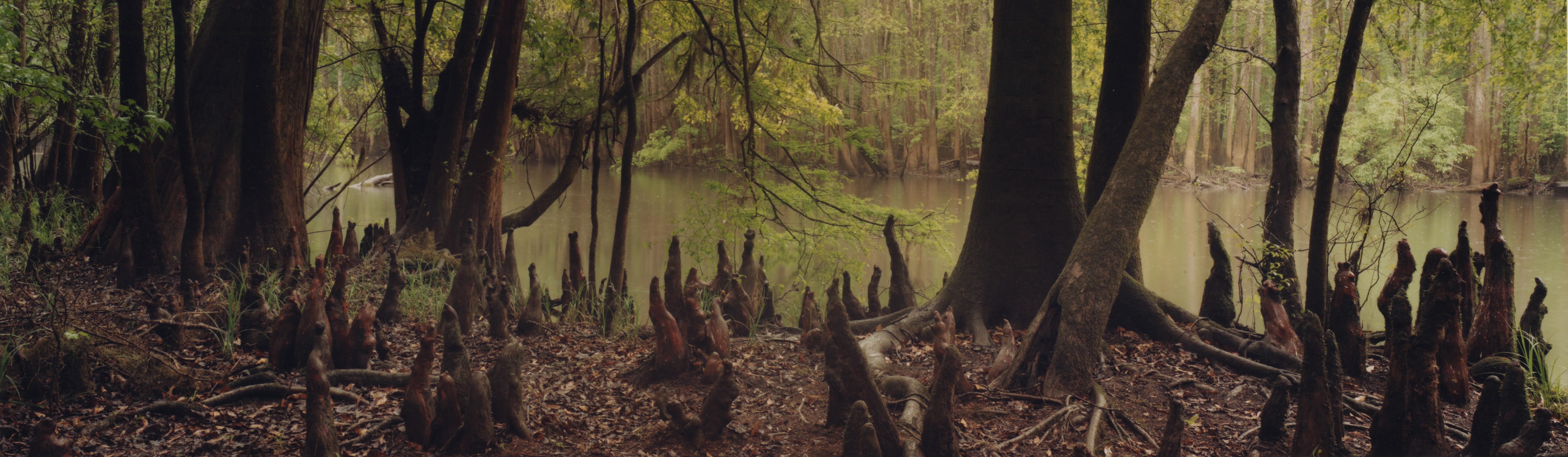
Congaree National Park protects about 26,692 acres of old-growth bottomland hardwood forest, cypress-tupelo sloughs, oxbow lakes, and floodplain habitat in central South Carolina. The park recorded 287,833 recreation visits in 2025, with many visitors starting on the Boardwalk Loop before exploring Cedar Creek, forest trails, and seasonal water routes. Congaree preserves the largest intact expanse of old-growth bottomland hardwood forest remaining in the southeastern United States.
Water levels define many visits. Trails can be dry and easy one week, then muddy or flooded the next, while Cedar Creek paddling trips change with rainfall and river conditions. Congaree is close to Columbia, South Carolina, but the forest can feel surprisingly wild once visitors leave the boardwalk.
Congaree was first protected as Congaree Swamp National Monument on October 18, 1976, and became Congaree National Park on November 10, 2003. The park's history includes Indigenous use, floodplain forests, logging pressure, citizen conservation, and continuing protection of one of the tallest deciduous forests in North America.
For more information see the park's Wikipedia page.
For official park information, visit the official NPS page.
Top Hikes
Use the NPS Trail Information page and Park Trail Guide for current Congaree trail and flood conditions. Most Congaree hikes have minimal elevation gain, but flooding, mud, insects, and heat can make easy mileage feel slower.
Boardwalk Loop Trail is a 2.6-mile (4.2 km) loop with minimal elevation gain through old-growth bottomland forest near the visitor center.
Weston Lake Loop Trail is a 4.4-mile (7.1 km) loop with minimal elevation gain through floodplain forest, oxbow lake scenery, and quiet backcountry sections.
Oakridge Trail is a 6.6-mile (10.6 km) loop with minimal elevation gain through mixed bottomland forest and less crowded Congaree scenery.
River Trail is a longer 10.4-mile (16.7 km) round-trip hike with minimal elevation gain to the Congaree River, best for hikers prepared for wet or muddy conditions.
Kingsnake Trail is one of Congaree's long hikes, about 11.7 miles (18.8 km) round trip with minimal elevation gain through remote forest, sloughs, and wildlife habitat.
Congaree National Park Backpacking
Backcountry Camping is available by permit and is often tied to hiking or paddling routes. The Cedar Creek Canoe Trail is another signature way to experience the park, but visitors should prepare for mosquitoes, flooding, heat, downed trees, and navigation challenges.
Things to Do in Congaree National Park
Use the NPS Things To Do page for current activity ideas, seasonal guidance, accessibility notes, and park alerts before planning your visit.
Cedar Creek paddling is one of the park's signature experiences. Canoeing and kayaking through quiet floodplain forest can be excellent, but visitors should check water levels, downed trees, insects, heat, and current conditions before launching.
Wildlife viewing, birding, and seasonal firefly viewing are strong reasons to visit Congaree at different times of year. Flooding, mosquitoes, humidity, and trail closures can change the best plan from week to week.
Congaree National Park Camping and Lodging
Longleaf Campground is Congaree's main frontcountry campground near the park entrance road. It has individual and group tent sites, and reservations are required before setting up camp.
Bluff Campground is a more walk-in style campground reached from the Bluff Trail area, with no vehicle access directly to the sites. Campers must carry gear in and reserve their site in advance.
Backcountry camping is available by permit for visitors who want a more remote floodplain experience. Mosquitoes, heat, flooding, navigation, and water levels are major planning factors.
Longleaf Campground and Bluff Campground reservations are handled through Recreation.gov.
Official Congaree National Park Resources
Use the official NPS page, park map, and current alerts, plus reservation links when planning a trip to Congaree National Park.