Gates of the Arctic National Park and Preserve Overview
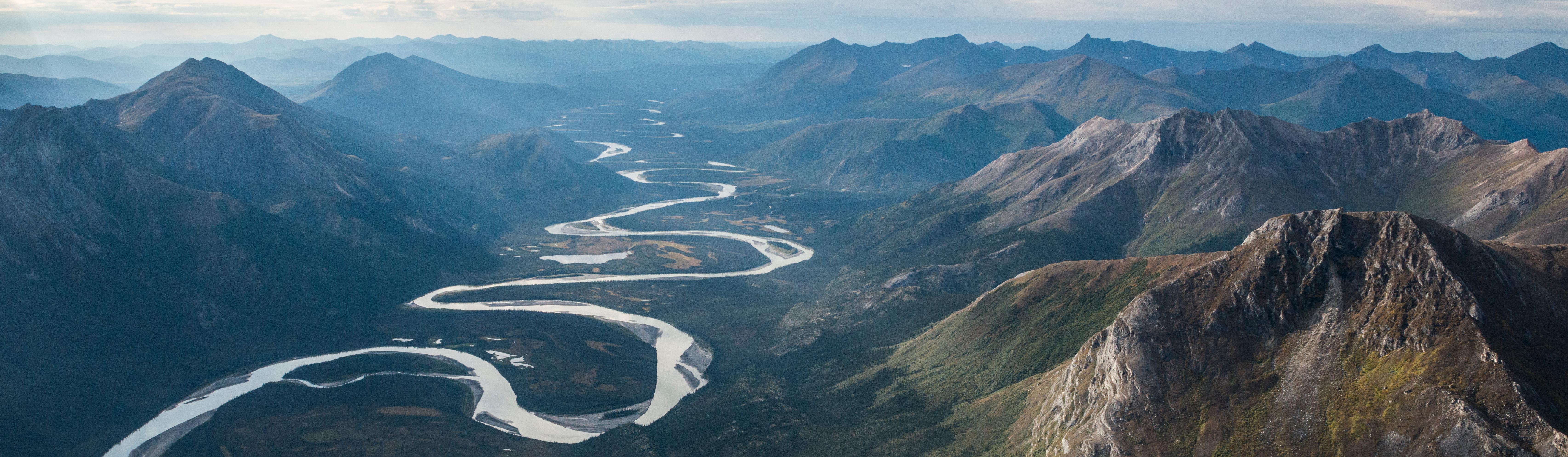
Gates of the Arctic National Park and Preserve protects about 8,472,506 acres of roadless Brooks Range wilderness, wild rivers, mountains, tundra, boreal forest, and intact Arctic ecosystems. The park recorded 14,923 recreation visits in 2025, keeping it among the least visited national parks in the United States. There are no roads, trails, campgrounds, visitor facilities, or established routes inside the park, so every trip requires a high level of self-reliance.
Most visitors arrive by air taxi and build trips around backpacking, rafting, packrafting, fishing, photography, or basecamp travel. Weather can change quickly, river crossings can become serious obstacles, and rescue may be delayed by distance and conditions. This is one of the least developed national parks in the United States.
Gates of the Arctic was first protected as a national monument in 1978 and became a national park and preserve on December 2, 1980, through the Alaska National Interest Lands Conservation Act. The park protects Indigenous homelands, caribou migration routes, designated wild rivers, and one of the largest wilderness areas in the National Park System.
For more information see the park's Wikipedia page.
For official park information, visit the official NPS page.
Top Wilderness Routes
Gates of the Arctic has no maintained trails, so hikes are wilderness routes rather than signed day hikes. Distances and elevation gain vary by landing location, route choice, river crossing, and weather.
Arrigetch Peaks routes are long wilderness hikes that can range from about 10 to 30 miles (16 to 48 km) with thousands of feet of elevation gain depending on camp location and side trips.
Kobuk River headwaters routes are backpacking trips of variable length with rolling tundra, river travel, and mountain approaches rather than a fixed trail distance.
Noatak River valley hikes are long tundra and gravel-bar routes with variable distance and elevation gain, often combined with rafting or flight-supported basecamps.
Anaktuvuk Pass day hikes can range from about 2 to 8 miles (3.2 to 12.9 km) with several hundred feet of elevation gain depending on the ridge or valley objective.
Alatna River routes are longer wilderness hiking and packrafting itineraries where mileage and elevation gain depend entirely on the chosen route, weather, and aircraft drop-off.
Gates of the Arctic National Park and Preserve Backpacking
There are no maintained hiking trails. Day travel and backpacking usually follow river valleys, gravel bars, tundra benches, ridgelines, or routes chosen by the group based on terrain and weather. Navigation skills are essential because maps, satellite communication, and route judgment replace signs and trail markers.
Backpacking is one of the main reasons to visit Gates of the Arctic, but trips should be planned conservatively. NPS Safety guidance is especially important because visitors need bear-resistant food storage, river crossing skills, cold-weather layers, insect protection, and flexible air taxi logistics for pickup and drop-off windows.
Things to Do in Gates of the Arctic National Park and Preserve
Use the NPS Things To Do page for current activity ideas, seasonal guidance, accessibility notes, and park alerts before planning your visit.
Rafting and floating Arctic rivers are major trip types for experienced visitors and guided groups. Popular routes can include portions of the Noatak, Kobuk, Alatna, John, Koyukuk, and other wild rivers depending on access, water level, and skill.
Wildlife viewing, photography, flightseeing, fishing, and basecamp trips are common ways to experience the Brooks Range without attempting a long point-to-point route. Visitors may see caribou, bears, Dall sheep, wolves, raptors, and broad tundra landscapes.
Flexible itineraries are essential because bush flights, weather, smoke, river conditions, and private inholdings can change plans quickly.
Gates of the Arctic National Park and Preserve Camping and Lodging
Backcountry camping is dispersed. Visitors need to be self-reliant, carry bear-resistant food storage, and coordinate air taxi logistics.
Official Gates of the Arctic National Park and Preserve Resources
Use the official NPS page, park map, and current alerts when planning a trip to Gates of the Arctic National Park and Preserve.