Death Valley National Park Overview
Death Valley National Park protects about 3,422,024 acres of salt flats, dunes, badlands, mountains, canyons, volcanic craters, and desert basins in California and Nevada. The park recorded 1,320,134 recreation visits in 2025, despite being the hottest, driest, and lowest national park in the United States. Because the park is enormous, travel times, heat, water, fuel, and road conditions are part of the planning, not side details.
Badwater Basin sits below sea level, while Telescope Peak rises over 11,000 feet above the valley floor. That vertical range creates very different experiences within one park, from salt flats and desert washes to high mountain viewpoints. Winter and spring are the most comfortable seasons for many visitors, while summer hiking can be dangerous outside the highest elevations.
Death Valley was first protected as a national monument on February 11, 1933, and became a national park on October 31, 1994. Its history includes Timbisha Shoshone homelands, mining, borax transport, desert travel routes, and long-running efforts to protect a vast and extreme desert landscape.
For more information see the park's Wikipedia page.
For official park information, visit the official NPS page.
Top Hikes
Use the NPS Hiking page for current Death Valley heat, flood, and road conditions. Low-elevation hikes are safest in cooler months, while high-elevation routes can hold snow or ice.
Badwater Salt Flat is a 1-mile (1.6 km) out-and-back walk to the salt flat edge with minimal elevation gain at the lowest point in North America.
Mesquite Flat Sand Dunes is commonly hiked as a 2-mile (3.2 km) route with about 185 feet (56 m) of elevation gain to reach the higher dunes.
Golden Canyon and Gower Gulch Loop is about 4.3 miles (6.9 km) with roughly 755 feet (230 m) of elevation gain through badlands, narrows, and colorful canyon walls.
Mosaic Canyon is about 4 miles (6.4 km) round trip with roughly 1,200 feet (366 m) of elevation gain through polished marble narrows and rocky canyon terrain.
Telescope Peak is the long high-country hike, about 14 miles (22.5 km) round trip with roughly 3,000 feet (914 m) of elevation gain to panoramic views over Death Valley and the Panamint Range.
Death Valley National Park Backpacking
NPS Backpacking guidance is important for remote canyons, washes, and mountain routes because these trips require desert experience. Water sources are scarce or unreliable, permits and road conditions should be checked, and summer overnight travel in low elevations is generally unsafe.
Things to Do in Death Valley National Park
Use the NPS Things To Do page for current activity ideas, seasonal guidance, accessibility notes, and park alerts before planning your visit.
Scenic driving is one of the best things to do in Death Valley National Park because the park is enormous. Badwater Basin, Zabriskie Point, Dante View, Artist Drive, Mesquite Flat Sand Dunes, Ubehebe Crater, and Father Crowley Vista can anchor a first visit.
Canyoneering and remote road travel are possible for experienced desert travelers. Visitors should use park safety resources, check road conditions, and carry extra water, food, fuel, navigation, and tire equipment.
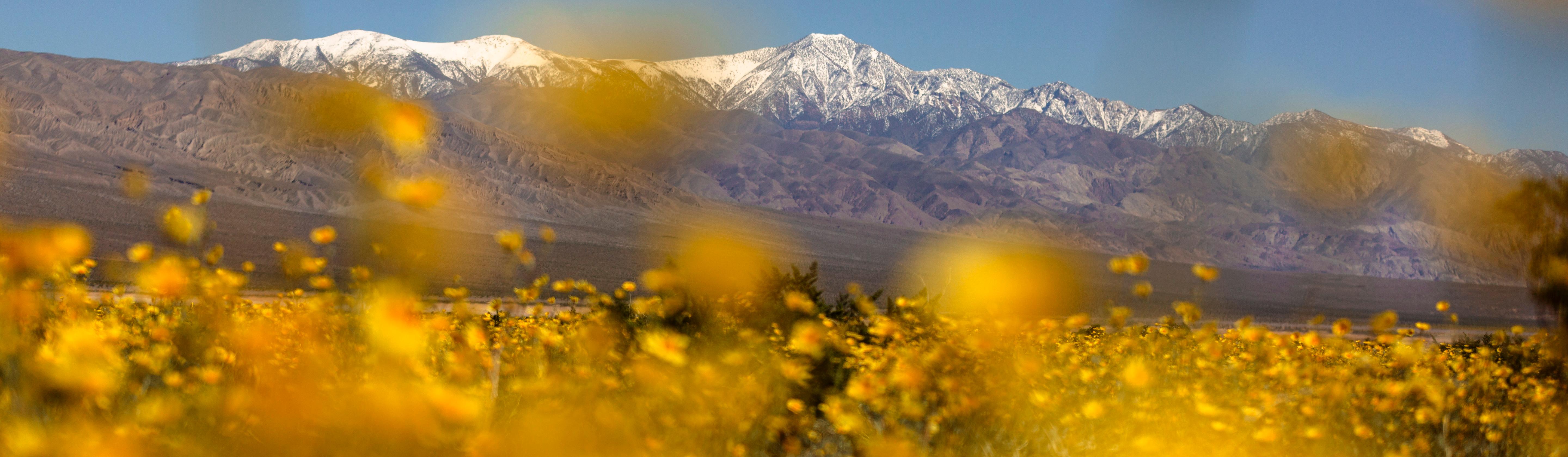
Stargazing, wildflower viewing in strong bloom years, photography, geology, and historic mining sites give the park strong year-round content beyond the most famous viewpoints.
Death Valley National Park Camping and Lodging
Furnace Creek Campground is the main developed campground in Death Valley and the primary NPS campground with seasonal reservations. It is centrally located near Furnace Creek services but can be very hot outside the cooler season.
Texas Springs Campground and Sunset Campground are lower-elevation Furnace Creek area campgrounds that typically serve cooler-season visitors. Texas Springs is smaller and generator-free, while Sunset is one of the park's largest campgrounds.
Stovepipe Wells Campground is a lower-elevation campground near Mesquite Flat Sand Dunes and Stovepipe Wells services. It is generally a cooler-season option because summer heat can be dangerous.
Mesquite Spring Campground is a northern park campground that can be useful for travelers visiting Ubehebe Crater, Scotty's Castle Road area, or the park's north end.
Emigrant Campground, Wildrose Campground, Thorndike Campground, and Mahogany Flat Campground provide more limited or higher-elevation camping options, with road, vehicle-length, and seasonal conditions varying by site. Use the NPS Camping page before choosing a campground.
Furnace Creek Campground reservations and reservable group sites are handled through Recreation.gov when available.
Official Death Valley National Park Resources
Use the official NPS page, park map, and current alerts, plus reservation links when planning a trip to Death Valley National Park.